




































Autodesk AEC Collection · Personal 12 months
£299.99£499.99−40%You save £200.00

 Windows
 Windows
Autodesk Civil 3D 2027 transforms civil design: more speed, precision and collaboration for roads, drainage and sustainable infrastructure of the future.

Imagine designing roads, drainage networks or railways without wasting time, with 3D models that update in real time and precise analysis directly from your work environment. Autodesk Civil 3D 2027 solves the chaos of traditional workflows, where manual changes cause errors and delays. With integrated smart tools, such as cloud-based drainage analysis and instant 3D visualisations, you take your civil projects to a higher level, reducing stress and increasing accuracy. It is the ideal companion for engineers who want efficiency without compromise.
Analyse catchments, channels and storage in the cloud without switching apps, get accurate results and automatically update models to prevent flooding and delays.
See instant 3D changes as you work, maintain visual control and communicate more effectively with your team and clients.
Automate catchment basins and feature lines with new nodes, freeing time from repetitive tasks so you can focus on creative design.
Work only on the terrain portions you need, resulting in lighter DWG files and smooth performance even on complex projects.
Manage curves with speed, curvature and cant in Project Explorer, reducing errors in complex rail alignments.
Calculate carbon footprint and import geological data, designing green infrastructure that meets environmental regulations.
Combine surveys, GIS data and DWG drawings in a single coordinated environment, eliminating data loss between project phases.
Reusable styles, templates and tools automate repetitive tasks, reducing errors and speeding up delivery.
If you are a civil engineer dealing with increasingly complex projects and tight deadlines, Civil 3D 2027 is your ally. Ideal for those working in infrastructure design firms managing roads, drainage or railways and needing to collaborate smoothly with remote teams. Or if you are a geotechnical engineer integrating borehole data into 3D models for reliable analysis. Think of yourself presenting design alternatives to a client in real time, without pulling all-nighters: this software understands you and saves you precious hours every week.
With Civil 3D 2027, your workflows become leaner: Dynamo automation reduces modelling time by 30–50% on repetitive tasks, allowing you to handle more projects without extra hires. Lighter files thanks to selective surfaces mean instant opening and smooth printing, ideal for multi-site teams. Cloud integration with Autodesk Docs enables secure sharing, cutting through emails and confused versions — no more site delays. Invest in tangible ROI: geotechnical precision and drainage analysis prevent costly revisions during execution, while sustainability tools position you as a green leader, attracting premium contracts. You save time, costs and resources while raising overall quality.

Civil 3D 2027 stands out through total integration: native drainage analysis and 3D visualisations eliminate jumping between software, keeping you productive. Unlike generic alternatives, it offers civil-specific automation — think Dynamo nodes ready for catchment basins, which other tools would require custom coding for. Cloud collaboration with Autodesk Construction Cloud unifies teams, reducing errors by 20–30%. Global coordinate support and sustainability features make it ready for international projects, with an intuitive interface that speeds up onboarding. It is an investment in the future: seamless updates and a large community ensure longevity.

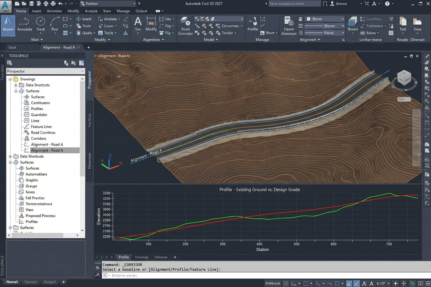
You are Marco, a road engineer: you start from a topographic survey, create alignments and profiles in minutes, then use Model Viewer to check live 3D cross-sections while the client watches — immediate approval. You move on to drainage analysis: configure catchments with Dynamo, the cloud calculates flows and suggests inlets; you edit and regenerate everything without exporting. For a railway project, in Project Explorer you manage cant on curves, simulating real speeds — the modeller updates, lightweight surfaces keep the PC responsive. Finally, you share on Autodesk Docs: the site team measures offsets from the alignment on mobile, instant feedback. The result? Early delivery, satisfied client, higher margins.

Civil 3D is Autodesk's software for infrastructure and civil engineering design: roads, terrain, water and sewer networks, with data-based modelling and drawing production. On Licensgo, Personal costs £79.99 for 1 year.
After purchase, on the activation page, enter the email address that should receive the licence. Autodesk activation is sent to that address. Delivery is entirely by email.
Yes. It is genuine Autodesk software with an invoice and email delivery. Personal and Commercial versions can be selected when ordering.
The licence covers 1 workstation: a single device for the 12-month subscription period.
It is an official annual Autodesk licence: 12 months of full Civil 3D use from activation, with all updates included. At expiry, renew on Licensgo with a customer-only discount, without reinstalling anything.